Millions to roast as mercury shoots over 40 degrees
Millions of Australians are expected to swelter as the mercury soars in the coming days and shoots over 40 degrees.
Temperatures will jump to more than 16 degrees above average in the southern capitals before suddenly plummeting.
The intense heat is forecast across the southeast of the country, from Friday and throughout the weekend and into Monday.
But there are also extreme rainfall warnings for north Queensland, with storms capable of dumping more than 200 millimetres.
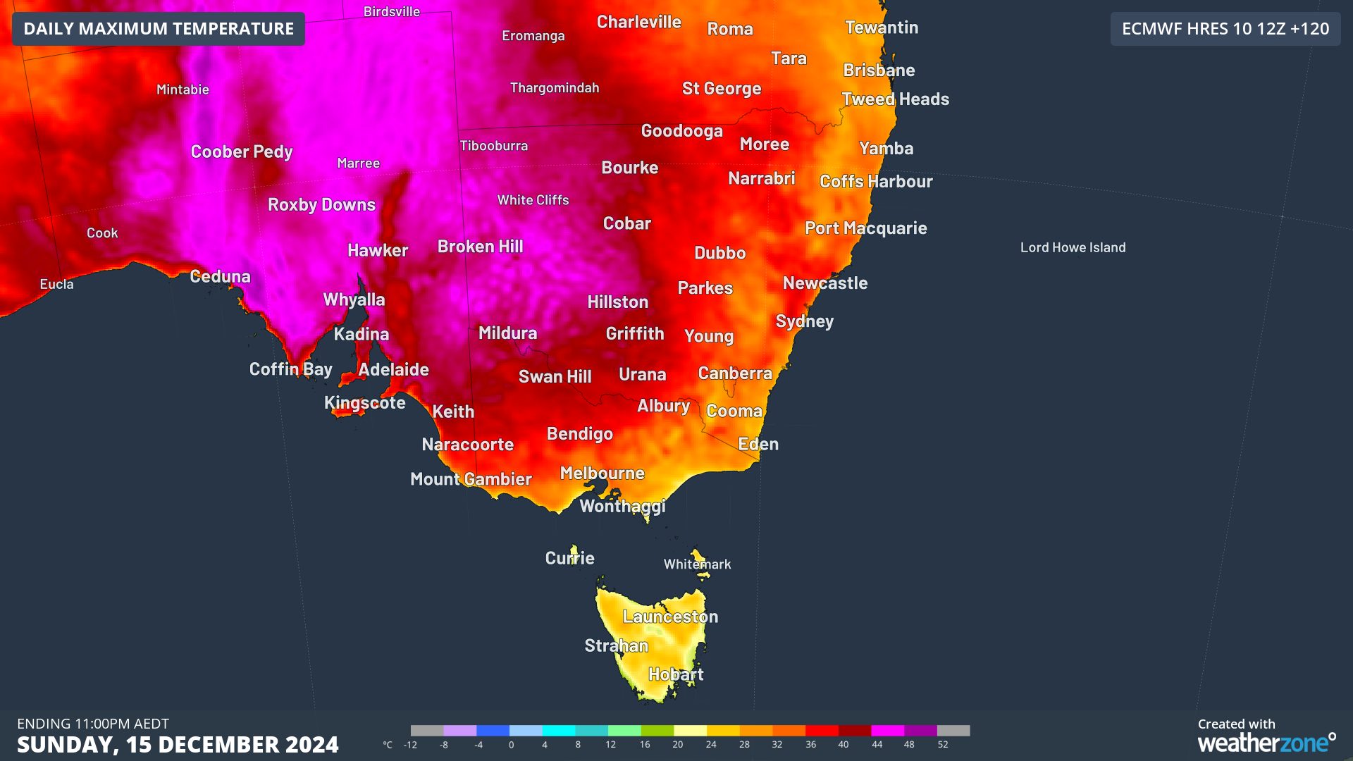
BOM senior meteorologist Angus Hines said it would start warming up on Saturday in parts of Victoria, South Australia, NSW, Tasmania and the ACT.
Sunday would be even hotter, with Adelaide expected to smash 40 degrees as Victoria and Tasmania temperatures keep climbing.
Then on Monday, Victoria and Tasmania would face their hottest day – hitting 40 degrees in Melbourne and into the 40s in parts of Victoria.
You might like


“Some spots in western NSW are likely to reach mid or potentially even upper 40s on Monday as well,” said Hines.
Forecaster Weatherzone said some computer models predicted maximums of 45 degrees in the Mallee, in north-west Victoria, on Monday. Victoria hasn’t had a temperature that high since 2020.
Then, very suddenly, it’s predicted the mercury will plummet as a cool change comes through later on Monday.
The temperature could potentially dive by more than 15 degrees in the space of just half an hour.
Hines said the heat would come “hand in hand” with strong southerly winds – which would whip up fire dangers.
“Through the weekend and particularly leading into early next week, widespread high fire dangers are forecast, with some districts likely to reach extreme fire danger,” he said.
“This may well make fire weather warnings and total fire bans in parts of the south-east.”
Stay informed, daily
Weatherzone said the sweeping heat would be driven by hot northerly winds ahead of a cold front.
“The heat is forecast to peak at about 41 degrees on Sunday in Adelaide and Monday in Melbourne, according to our meteorologists,” its forecast said.
“Adelaide will continue to swelter into Sunday evening, with temperatures remaining in the mid 30s until around 9pm.
“Night-time temperatures will also be very warm, with Adelaide’s minimum temperature not forecast to drop below 27 degrees on Sunday night.
“This is 12 degrees above the December average of 15 degrees, caused by a warm northerly airmass sitting over the city on Sunday night and Monday morning.”
There is still some uncertainty in the timing of the cool change, but Weatherzone said it should arrive in Adelaide on Monday morning, cooling temperatures in the afternoon.
“The front and southerly change will then continue on their path towards Victoria, arriving in Melbourne on Monday afternoon or early evening.
“Both capital cities will see the temperature drop into the low to mid 20s on Tuesday next week, providing some relief after the oppressive heat.”
‘Incredible’ rainfall
As the southern areas sweat, northern Queensland will be drenched.
Storms began overnight Wednesday and unleashed as much as 162 millimetres near Mackay.
An “incredible” 109 millimetres fell in an hour at Cairns Airport on Wednesday night into Thursday morning.
The wet weather is expected to continue in far north Queensland over the weekend.
Hines said there would be persistent heavy falls between Townsville and Mackay on Friday, “with more the 200 millimetres definitely a possible outcome”.
Want to see more stories from InDaily SA in your Google search results?
- Click here to set InDaily SA as a preferred source.
- Tick the box next to "InDaily SA". That's it.


